Acara19
CCA Members
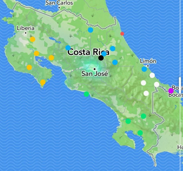
I have mapped out (almost) all the amatitlania locales I've seen from Costa Rica. Pretty neat to see how the species divide themselves up.
Yellow represents yellow cabuya type nigrofasciata (former siquia)
Black represents the normal colored nigrofasciata we're familiar with
Red represents the dark grey stripeless red finned "siquia" with almost septemfasciata esque females
Blue represents septemfasciata
Green represents sajica
Purple represents kanna
White represents myrnae
There was one more alleged myrnae locale, Rio cocotis, which I couldn't find on any map.


